BOM UPDATE: Cyclone expected to develop in Coral Sea today
Weather Watch

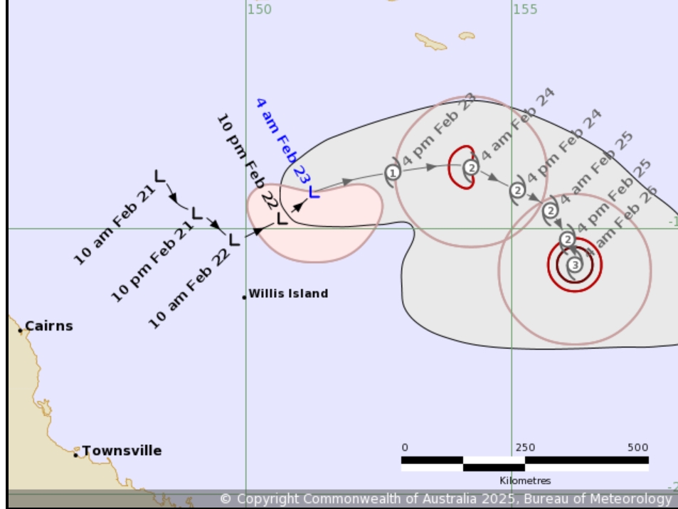
The Bureau of Meteorology has forecast for a tropical low off the North Queensland coast to develop into a category two cyclone today, but tracking of the system gives a strong indication it will not impact the Douglas Shire region.
Located 470km east northeast of Cairns when the BOM gave its first reports that the low is likely to become a category one tropical cyclone by 10am today, Sunday February 23, the weather experts predicted it would then intensify.
“During next week, the system is expected to turn southeast and then south while continuing to strengthen,” the Bureau said.
“Considerable uncertainty exists in the track the system will take beyond that, but there is a risk it will move closer to the central Queensland coast late next week.”
Senior meteorologist Angus Hines said considerable uncertainty remained over the path the system would take.
“If it does develop (into a cyclone), it’s not likely to move anywhere quickly, lingering in the Coral Sea for several days,” he said.
“This could bring some gusty conditions, showers and increased swell to the central and northern Queensland coast, but otherwise will have minimal impact on our weather.
“There are a few paths it (the weather system) could follow.
Updated BOM modelling indicates the system could close in on Hamilton Island by 10am next Saturday.
Meanwhile in Cairns, residents are advised that king tides will be experienced in from Monday, February 24, through to Monday, March 3, peaking on Friday, February 28.
Cairns Regional Council reminded motorists that tidal flooding is saltwater, which can damage cars on contact. Avoid parking cars in low-lying tidal areas and never drive through floodwaters.
Motorists should drive carefully and slowly, not only for the safety of road users and pedestrians, but to lessen the impact of bow waves, which can push water into nearby properties.
Council may close roads which are inundated by tidal flooding to prevent damage to private property.
Motorists are required to adhere to signs advising the road is closed and should find an alternative route until the road is reopened.
The impact of these king tides on low lying areas could be exacerbated by heavy rainfall.
King tide levels for Cairns are expected at the following times (other areas may vary):
- Monday 24 February: 2.9m at 7.27am
- Tuesday 25 February: 3.1m at 7.55am
- Wednesday 26 February: 3.27m at 8.26am
- Thursday 27 February: 3.39m at 8.58am
- Friday 28 February: 3.41m at 9.30am
- Saturday 1 March: 3.31m at 10am
- Sunday 2 March: 3.11m at 10.31am
- Monday 3 March: 2.79m at 11.03am
Support public interest journalism
Help us to continue covering local stories that matter. Please consider supporting below.


